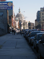
I walked over there this afternoon to take a short photo tour. I began at Grand Street since south of there is only the old Domino Sugar factory and not much has been happening to that lately, meaning it hasn't been torn down to make way for something more contemporary (and shouldn't be, either).

Instead of linking to a Google map this time, I thought I'd just drop in a portion of the NYC map for that area to get you oriented, though the streets just go in numerical order and I'm not going to stray from Kent Ave.much (that's the thoroughfare bordering the riverfront property).
At the foot of Grand Street is the Grand Ferry Park, a little blip on the river with some benches and a nice view of Manhattan.

That's the end of Grand Street with the park beyond; actually, it's not at all a bad place to go to catch some river breezes on a humid summer night or to read a book on a spring afternoon. You can't argue with the view. And as small as it is, it is infinitely nicer than the excuse for a park further north that's supposed to be a sop for putting up with the skyscrapers in our midst.
 Grand Ferry Park
Nearby is a narrow street called River Street that only goes a few block north. There isn't anything to it, just a remnant of Williamsburg's industrial riverfront past, but I wanted to check out any other streets that might go down to the water.
 And no, no more ways down to the East River, just fences across the street openings, which didn't surprise me.
 North 1st Street
Metropolitan Avenue
 North 3rd Street
Those views of the water, though, are so enticing; so near and yet so far. I didn't realize there were many big waves along that part of the river, still you never know when you may need a surf board . . .
 River Street near Metropolitan Ave.
I was thinking that it probably won't be long before that disappears unless the denizens of the skyscrapers want to keep a few "quaint" businesses around as a reminder of Williamsburg's seafaring past (there were a lot of ferries at one time).
But then it's back out to Kent Ave. for the real action.
 North 3rd St & Kent Ave.
At least the developers are getting colorful in their construction netting. If they kept it that way all the time we could at least pretend it was a Christo.
 To N. 4th St. & Kent Ave.
About a year ago they changed the traffic pattern on Kent Ave. from a a two-way to a one-way street, heading north, and as they did on Broadway in the city, they painted in all those cute little rectangles for cars to park in the middle of the street. And since you already feel like you're walking at the bottom of a canyon it's very crowded and claustrophobic.
 North 4th St. & Kent Ave.
There are a number of these wide driveways that lead toward the river but there is always a fence or barrier of some kind at the other end between you and the water. At least at the one large apartment building on the river south of Broadway, the public has access to a nice waterfront esplanade behind the building. Maybe, when all is said and done around here, the same situation will develop . . . maybe.
 North 4th St. & Kent Ave.
I mentioned in an earlier post about a Duane-Reade that was planned for a large new building almost completed at Bedford Avenue at North 3rd St, across from our neighborhood pharmacy, King's. True to form, Duane-Reade fills almost the entire block here, so you can see why they would want to open another on Bedford Ave. A three-block walk for a bottle of water is intolerable; I always figured it was part of their master plan to have no New Yorker more than a block away from a Duane-Reade store.
 North 5th St. & Kent Ave.
Finally a tall building. I was looking through my photo files and beginning to think I had imagined these giants.
 North 5th St. & Kent Ave.
And more!
 North 6th St. & Kent Ave.
And more!
Back at North 5th St. you can wander down what is either a street or a private driveway, I am not sure which. There are no signs saying "Private Property" "Residents Only" "Keep Out--This Means YOU"! But the street doesn't show on the map either.
 North 5th & Kent Ave.
And there are stores and sidewalks so maybe the public is welcome or maybe it's even an extension of N. 5th. Not that this always matters; on maps Washington Avenue is always shown as cutting through the old Brooklyn Navy Yard and connecting with Clymer St. but even now that it's New York City property and no longer federal, the public is still kept out.
Still, there is this sign along the roadway above . . .

North 5th Street Pier. Hmm. There is nothing there now as you can see; a fence and some construction equipment. But maybe there is actually going to be a "pier" on the river with public access at some future date.
 North 6th St. & Kent Ave.
That looks promising, too . . . so far.
What fascinates me is the contrast between the two sides of Kent Avenue. One one side Metropolis or Gotham City, on the other Smalltown, U.S.A.
 North 6th St. & Kent Ave.
 North 7th St. & Kent Ave.
 North 8th St. & Kent Ave.
Maybe the developers will want to keep those blocks intact as a sort of Olde Williamsburgh theme park.
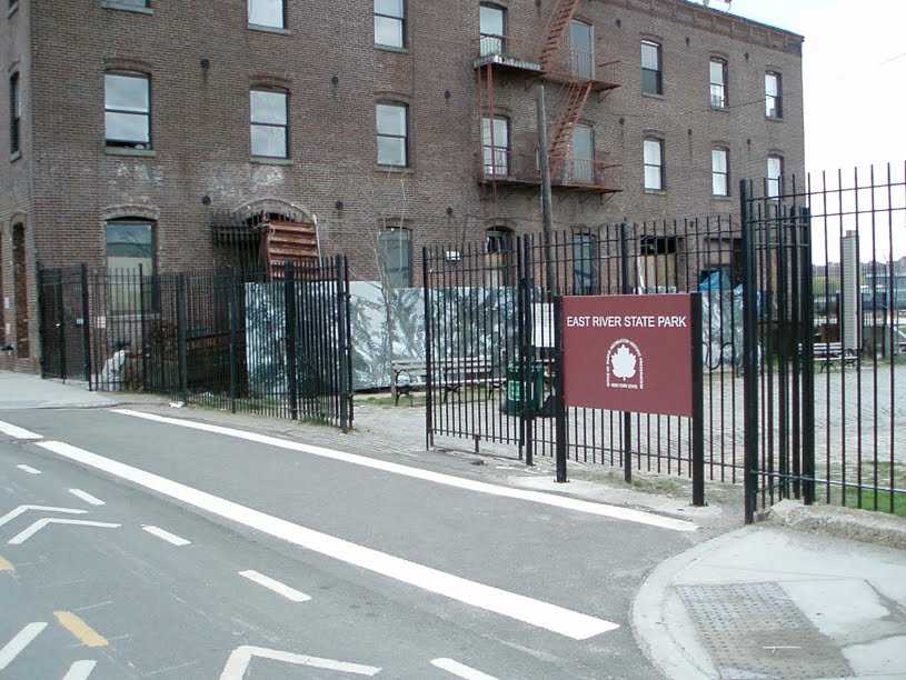
East River State Park
"Look, Ma! A state park!! Our own state park right here in Williamsburg! Ain't we lucky?"
 North 8th St. & Kent Ave.
 East River State Park
"Look at those cobblestones, ma! This sure is historical!"
 East River State Park
 East River State Park
You would be hard pressed to find a more desolate stretch of land in the vicinity. Oh, like Grand Ferry Park, the view can't be faulted . . .
 View from East River State Park
. . . but to call it a park is a bit of a stretch. In fact, look at this view (again from the NYC map) of the area from 1996:

Those two large parallel white rectangles near the bottom left are the site of the park. You can see that the buildings were taken down to the foundations (which were left) and some benches and trash cans were scattered around. They didn't even have to plant grass.
 East River State Park
 East River State Park
Or maybe the state has a grudge for some reason because a scant block away further north is a city park . . . and behind this unassuming entrance

lurks a gorgeous soccer field with a view to die for.
 Bushwick Inlet Park
 Bushwick Inlet Park
And the damn thing is . . . we're nowhere near Bushwick.