Williamsburg has an historic/literary site and an actual historic district, even if it is barely a block long. And I don't mean the Domino Sugar factory.
Henry Miller, probably acclaimed and reviled in equal measure, lived on Driggs Ave. as a child. His childhood home still stands, somewhat isolated, between Grand Street and Metropolitan Avenue, with a grass off-street parking lot on one side and a marble and granite storage yard on the other.
 Henry Miller's childhood home, 662 Driggs Ave., Williamsburg
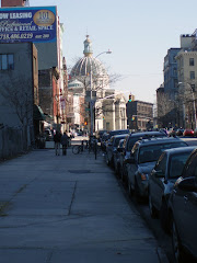
In his writings he was said to have described being enchanted by Fillmore Place, a short block of row houses that runs between Driggs Ave. and Roebling St. around fifty feet or so south of his home.
 Fillmore Place from Driggs Ave. to Roebling St.
I read a few years ago that there was an application before the city to have Fillmore Place declared an historic district and I have to confess that I thought it was a joke. It turns out that the laugh is on me because a little over a year ago, without much fanfare that I can remember, Fillmore Place was declared a city historic district.
 Fillmore Place, north side from Roebling St. to Driggs Ave.
It is said that the houses all date from the 1850s when Williamsburg was just starting to change from a "rural village to an urban neighborhood." That's another indication of just how wrong the city map on nyc.gov is in it's building information, since it claims that all the buildings there date from 1899 except for one or two that were built in 1915 and 1920.
 Fillmore Place, south side from Roebling Street to Driggs Ave.
So, I raise my Corona in a toast to Henry Miller, Millard Fillmore, and his place. It's probably the most respect that accidental, pro-slavery president has gotten since his death.
 Fillmore Place near the corner of Driggs Ave.
This is a Fourth of July blog entry but not for a July 4th walk. I am resting up after a longish, hot walk yesterday. Last year on July 4th was my great Flatbush Avenue trek when I walked out Flatbush Avenue to Avenue V, across through Marine Park into Gerritsen Beach, over to Sheepshead Bay, and back to Williamsburg along Bedford Avenue. I just wasn't up for something like that this year . . . yet. It's early days, though.
Yesterday, I stayed closer to home around Williamsburg, Clinton Hill, Crown Heights, and Bedford-Stuyvesant. I thought that just putting down here an average walk would be nice. That is, a walk that came about partly by accident and not one planned in advance like the Broadway walk (which I haven't finished with yet, blog-wise, I just needed a break).
I tend to take a lot of pictures on my walks, a lot more than I ever put in here. If anything catches my eye, I shoot a picture. It's all digital; after I download it to my P.C., if it's garbage, I trash it, if not, I keep it archived and use it or not. So I may drop in more pictures than usual here just to give you an idea of what interests me.
First of all, I am definitely not a "form follows function" kind of guy. Just the opposite, in fact; I really enjoy highly decorated buildings: Gothic Revival, Romanesque Revival; even less highly decorated ones if they're at least made of something other than glass or fiberglass. All of which makes the neighborhoods around me great places to walk. For example . . .
 Bedford and Division Aves.
This is the kind of shot I take a lot. Whenever I see a building either under construction or being demolished I like to make a record of its being partway to something or nothing.
 Bedford Ave. near Division Ave.
I enjoy, too, the variously decorated doorways of the houses I pass. Walking into a house through a doorway like that would make me feel special.
 Bedford Ave. at Clymer St.
This has been in this shape for quite a while now, with the scaffolding around it. I'm not even sure if it's being used for anything or whether the scaffolding is just to protect passersby in case something falls off. It could look wonderful if it were fixed up.
 Bedford Ave. at Ross St.
Another interesting doorway.
 Bedford Ave. between Ross and Rodney Sts.
And another interesting doorway, though one a bit worse for wear. As the photo below shows it appears it was once an insurance office.
 Bedford Ave. between Ross and Rodney Sts.
 Bedford Avenue at Rodney St.
The following three shots are from the same building. All of these buildings are in the heart of Hasidic South Williamsburg; a large building like this is not, I imagine, a residence, but since my knowledge of Hebrew is zero, I can't read any of the identifying signs on most of the neighborhood buildings. I like them, though (the buildings, not the signs).
 Bedford Ave. at Rodney St.
I have another amateur's theory about neighborhoods like this in New York, that the ones with the best preserved architecture are often where the residents haven't either the means or the interest to change anything.
 Bedford Ave. at Rodney St.
Bed-Stuy retained an enormous number of beautiful brownstones and row houses because it became a depressed neighborhood and the residents didn't have the means to replace the buildings even if they wanted to; at least to some extent that was true, there have always been urban renewal projects and new housing here and there in that neighborhood. And since it had the reputation as a high crime neighborhood, it didn't attract the gentrifiers of today.
 Bedford Ave. at Rodney St.
For the Hasidic community in South Williamsburg, their religion comes first, not replacing the housing to make it more up to date. Though even that is only partly true as I'll show later.
 Bedford Ave. between Rodney and Keap Sts.
 Bedford Ave. at Keap St.
A little colonnade.
 Bedford Ave. between Hooper and Hewes Sts.
 Bedford Ave. near Hewes St.
 Bedford Ave. near Hewes St.
Most of these photos don't need comments. I took the shots because I liked whatever it was I was shooting: door, window, wall, roof, whatever.
 Bedford Ave. near Hewes St.
It's too bad they blocked up the windows in the bottom row; too bad, too, that they replaced the old windows that must have been there with modern combination storm and screen windows.
 Bedford Ave. at Rutledge St.
These, I thought when I saw them, are a lot of fun. This is why you always have to be looking up as well as straight ahead or to the side when you're wandering. The fact that something would be way up almost out of sight didn't deter builders or architects from adding these whimsical flourishes.
 Bedford Ave, near Heyward St.
There is an entire row of buildings between Rutledge and Heyward Streets with those faces.
Now, what I said about the Hasidic community not being interested in new buildings applies, as far as I can tell, to just not tearing down the older turn of the century housing. Where there are vacant lots, or rundown commercial structures, or abandoned buildings in bad repair, they will be replaced by very large apartment blocks like those below.
 Bedford Ave. at Lynch St.
You can see a sliver of the older section of South Williamsburg just on the right edge of the picture. The intersection above where Lynch Street meets Wallabout is where those older, comfortable, tree shaded streets end. In fact the next block, Flushing Ave., is where Williamsburg ends and Bedford-Stuyvesant begins.
 Bedford Ave., looking south from Flushing Ave.
 Bedford Ave., looking north from Willoughby Ave. toward Myrtle Ave.
Years ago when I walked out this way, I recall it being a pretty derelict area. I'm not a great fan of these massive apartment blocks but what they replaced was no great loss.
On the other hand, as you get further into Bedford-Stuyvesant, you get more and more blocks that I hope will be preserved.
 Bedford Ave., looking south from Willoughby Ave. toward DeKalb Ave.
 Bedford Ave., looking north from DeKalb Ave. toward Willoughby Ave.
Now we're getting closer to what was the middle-class, professional-class part of Bed-Stuy at the turn of the century, Pratt Institute and Clinton Hill are just off to the west a few blocks.
 Bedford Ave. between Willoughby and DeKalb Aves.
 Bedford Ave. at DeKalb Ave.
The return of the trees. As I turn right up DeKalb to Pratt Institute, it's also the return of some almanac pages.
In 1889 when Charles Pratt founded the Pratt Institute, he also founded a kind of savings and loan, building society called The Thrift. That was way back when bankers actually thought it was a good idea if people saved money, silly people that they were. Were something like that built today it would no doubt be called The Spendthrift.

It was built right down the street from the Pratt Institute of the time. I had been walking by it for years without knowing what it was. Of course now it's actually inside the gates of the expanded Pratt campus and is no longer a bank but just another Pratt administration building. But it is still there.
 The Thrift, DeKalb Ave. at Ryerson St.
As you can see from the buildings on the original advertisement, when it was built there actually was a Ryerson Street that ran from Willoughby Ave. to DeKalb Ave. As you can see from the photo above, the campus has consumed what was Ryerson St., even though it still shows up on New York City maps.
 The Thrift, DeKalb Ave. at Ryerson St.
It's too bad it isn't still a savings and loan, students need practice with that as much as with academics.
 The Thrift, DeKalb Ave. at Ryerson St.
The architecture of The Thrift and most of the other old bank buildings I pass on my walks reminds me that there was a time, too, when the saving and spending of money was an important issue for individuals and for banks and banks wanted their customers to realize this from the moment they walked in the door. Not to say that the banks didn't care about making money for themselves, they always have, but I don't think they were the scoundrels they are today. Or maybe they were just larger-than-life scoundrels instead of the sleazy types we see in the news these days.
Charles Pratt was also involved in another academic venture in the neighborhood called Adelphi College. It was only a couple of blocks away at Lafayette Ave.
 A bad reproduction but the original probably didn't look much better. That building is still there, too, though it looks slightly different. Possibly I took my shot from another angle.
 Lafayette Ave. and St. James Place
It's now a part of Pratt itself. We are in Clinton Hill at this point. We crossed from Bed-Stuy into Clinton Hill when we got to Pratt. A hundred years or so ago, I'm not sure there was a big difference between the two. I think they both attracted an upper-middle class and professional class as residents. But I'm no expert on the subject. What Clinton Hill did boast (and not just Clinton Hill) was another feature of a comfortable neighborhood, the conservatory-trained instructor of music; piano, singing, whatever. There are small ads for these classes throughout the various issues of the Brooklyn Eagle Almanac. The only reason the one below caught my eye was the photo. That building (what you can see of it) looked familiar.

The Boices (mother and daughter, perhaps?) had studios at Carnegie Hall, no doubt as big a draw then as now.
 Washington Ave. at Greene Ave.
I was right in thinking I knew the building. Unfortunately, there is construction being done but at least the section in the photo remains visible. It's some kind of hotel now, apparently. And looking at the whole building below, you can easily imagine singing and piano music and violin music pouring from the different windows.
 Washington Ave. at Greene Ave.
And speaking of hotels (this is the last advertisement for today!) . . .
 Still here . . .
 Washington Ave. at Greene Ave.
And again, buildings I have walked past I don't know how many times without looking up . . .
 Gates Ave. at Clinton Ave.
 Gates Ave. at Clinton Ave.From Gates Avenue I headed across Fulton St. and Atlantic Ave. and up Vanderbilt Ave. to the library. I hadn't meant to go there that day; as a matter of fact I changed my library day to Wednesday or Thursday evening just so that I wouldn't have to start each weekend walk by going there, no matter where else I had it in mind to go. But the mystery I had borrowed on Thursday had turned out to be a real downer and I decided to bring it back and get something else.
After leaving the library, the walk really was without any plan except to go back to Williamsburg.
 Bedford Ave. and Lincoln Place.
I walked out Eastern Parkway to Bedford Ave. and noticed this building from the corner, another place I had passed many times that I wanted to get a picture of because it is obviously a former theater (now a Baptist church).
 Bedford Ave. and Lincoln Place
Old Brooklyn theatres have been on my mind lately and although I don't find a record of a turn of the century theatre at that corner, still I wanted a picture in case I tracked down what it was. It looks too classy to have been a mere movie theatre. (I see I've even been using the older spelling, theatre since that's what I've been seeing in print lately in the Brooklyn Daily Eagle Almanac.)
I turned the corner onto St. John's Place and this row of houses caught my eye. It would look even nicer if the fire escape in the middle were switched to the back of the building and if the missing cornice section were replaced. Still, I liked the looks of the row and I have only myself to please.
 St. John's Place near Rogers Ave.
From there I just continued walking down St. John's Place, a street I'm fairly sure I had never been on, that far over anyway, and noticed this block near New York Avenue. This is Crown Heights by the way, an area that was a magnet for wealthy Brooklynites at the turn of the century, especially after Eastern Parkway was laid out.
 St. John's Place near New York Ave.
The next couple of shots are in the block between New York Ave. and Brooklyn Ave.
 St. John's Place between New York and Brooklyn Aves.
Though I'd guess these weren't housing for the wealthy; but pleasant rows of homes nonetheless.
 St. John's Place between New York and Brooklyn Aves.
At the next corner, at Brooklyn Ave., is the church of St. Gregory the Great, a striking looking edifice in a perfect setting. If I can remember anything from college art history classes, I think it's designed after the early Italian basilicas.
 St. John's Place and Brooklyn Ave.
As much as I love walking out in the summer, I have to admit that shots like that one above might work better at some other time of the year when the trees are bare of leaves. In fact, trees can be a big nuisance in trying to take photos of buildings during the summer.

St. John's Place and Brooklyn Ave.
This red building was across the street; I just happen to like its looks, especially the eve overhanging the third floor apartments.
 St. John's Place and Brooklyn Ave.
 Brooklyn Ave. and Sterling Place
 Brooklyn Ave. between Park Place and Prospect Place
That cute little suburban style cottage is across from Brower Park and next to an elementary school. Across the entire front wall of the school is painted a mural decrying gun violence in the city. Since my friends and my colleagues at work will confirm that I am extraordinarily anti-gun, you can bet that I took shots of the whole mural.
They are all at Brooklyn Ave. between Park Place and Prospect Place


The next two shots are from right around the corner on Prospect Place, Some of these places look like they've been plucked out Bronxville or Riverdale and dropped into the heart of Brooklyn.
 Prospect Place near Brooklyn Ave.
And some look like they may not make it. I guess it's a toss up whether this is coming down or in the process of being saved or maybe just being left to deteriorate.
 Prospect Place at Brooklyn Avenue
From there I cut across Brower Park and through St. Mark's Place to Albany Avenue, skirting the edge of the Albany Houses and heading north to Atlantic Ave. and then to Fulton St.
 Albany Ave. between Pacific St. and Dean St.
I love the way the row of houses huddles under those stately shade trees. We are back in Bedford-Stuyvesant again; have been since the Prospect Place mural.
A block further down between Atlantic Ave. and Pacific St. is this row. Just to give you an idea of how a street can change from one block to the next.
 Albany Ave. at Atlantic Ave.
Fulton Street, which historically runs from the ferry landing on the East River near the Brooklyn Bridge out almost to Cypress Hills at Broadway Junction is the main shopping street of Bed-Stuy.
 Fulton St. from Albany Ave. to Throop Ave.
It marks a definite division betwen the main part of Bed-Stuy to the north and the strip along Crown Heights. While some avenues, Franklin, Bedford, Nostrand, cross from one section to the other, many avenues don't or change names at Fulton St. Albany Ave., except for a half block, stops at Fulton St.,Throop Ave. begins at Fulton St.

 Looking down Throop Ave. from Fulton St.
The next group of pictures is taken in and around Stuyvesant Heights, a section of Bed-Stuy roughly from Tompkins Ave. to Stuyvesant Ave. and from Fulton down to Macon Streets. It's a New York City historic district whose homes rival those in the more popularly known Brooklyn Heights and Park Slope. Not that I purposely chose this area on Saturday, it's just where I ended up.
 Throop Ave. and Decatur St.
 Throop Ave. and MacDonough St. Our Lady of Victory R.C. Church
 MacDonough St. looking toward Throop Ave.
 MacDonough St. looking toward Throop Ave.
 MacDonough St. looking toward Throop Ave.
 MacDonough St. looking toward Tompkins Ave.
I like the way the tower of the 1st AME Zion Church rises up over the trees. In fact, the sight of a tall church tower from blocks away can often change the direction of one of my walks since I often want to see what the building looks like.
 First A.M.E. Zion Church at Tompkins Ave. and MacDonough St.
 Throop Ave. and Macon St.
 Throop Ave. at Macon St. Newman Memorial United Methodist Church
 Jefferson St. between Throop and Tompkins Aves.
After wandering around the neighborhood for a bit, I decided to take Tompkins Ave. down into Williamsburg. I'm not a big fan of Throop as it gets to Williamsburg, though none of those streets is much better or worse than the others. Little by little, the closer to Williamsburg, the more run down the buildings, the sparser the trees, the more commercial and light industrial the neighborhood.
 Tompkins Ave. at Gates Ave.
 Tompkins Ave. and Quincy St.
 Tompkins Ave. and Lexington Ave.
 Tompkins Ave. and Lafayette St.
 Tompkins Ave. near DeKalb Ave. Mt. Pisgah Baptist Church
This is where the battery on my camera died. I think I took around 190 photos that day.
This was probably an average walk; shorter than most if anything. On a summer weekend it's not unusual for me to be out six or seven hours, making the most out of every hour of daylight the season has to offer. The heat of this particular weekend kept the walk shorter than it normally would be.
Nor am I picking deliberately the most "picturesque" areas to walk through. Most of Bed-Stuy and Crown Heights are like this. I can't help it if a row of well-preserved brownstones makes a better picture than an empty lot next to a deli. But I do take pictures everywhere I go and will try to get as many in here as I can. It's just that it's a tiring job putting this all together. In a way, more tiring than the walks themselves.

 Henry Miller's childhood home, 662 Driggs Ave., Williamsburg
 Fillmore Place from Driggs Ave. to Roebling St.
 Fillmore Place, north side from Roebling St. to Driggs Ave.
 Fillmore Place, south side from Roebling Street to Driggs Ave.
 Fillmore Place near the corner of Driggs Ave.